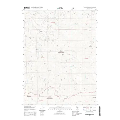
2015 Map of Black Rock Mountain
USGS Topo · Published 2015About this map
Payne and Penney mark the sparse human footprint in this mountainous terrain where the Trinity National Forest meets the Mendocino National Forest. The landscape is defined by the complex drainage of the S Fork Trinity River and its various branches, including the E Fork S Fork Trinity River and the N Fork Middle Fork Eel River. This 2015 survey reveals a high-elevation environment dominated by prominent peaks and ridges like Black Rock Mountain, Skylight Ridge, and the distinctively named Tombstone Rock. Unique features such as Blue Slide and Hermit Rock suggest a geography shaped by significant natural geological movement. The presence of Fern Glade and Penney Glades indicates pockets of moisture-rich meadows scattered among the high divides like Buck Ridge and Mule Ridge.
Find a feature on this map
36 named features on this map. Tap any name to fly to it.
Don’t see what you’re looking for? This feature index may not catch every label — zoom into the map to look around manually.
Map Details
Editions of this 2015 Black Rock Mountain Map
This is the sole edition of this map. No revisions or reprints were ever made.
Other maps of this area

1890 · Red Bluff
USGS Topo · 1:250,000

1894 · Red Bluff
USGS Topo · 1:250,000

1931 · Hoaglin
USGS Topo · 1:96,000

1935 · Hoaglin
USGS Topo · 1:125,000

1951 · Chanchelulla Peak
USGS Topo · 1:62,500

1953 · Blackrock Mtn
USGS Topo · 1:62,500

1954 · Dubakella Mtn
USGS Topo · 1:62,500

1954 · Blackrock Mtn
USGS Topo · 1:62,500

1954 · Yolla Bolly
USGS Topo · 1:62,500

1958 · Redding
USGS Topo · 1:250,000