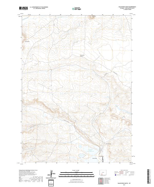
2021 Map of Black Rock South
USGS Topo · Published 2021About this map
The Continental Divide traverses this high-desert landscape in Sweetwater County, marking a fundamental hydrologic boundary in the American West. The terrain is characterized by a network of drainage systems and intermittent water sources, including the headwaters of Black Rock Cr and the seasonal waters of Ninemile Wash. Industrial activity and land management are evident in the south, where the Jim Bridger Project Evaporation Pond and Potash Wash sit near The Meadows. This arid region is navigated by a series of graded routes such as Superior Cutoff Rd and Bitter Creek Rd, which provide access to landmarks like Spring Butte and Black Rock. The presence of Radon Springs suggests the location of vital water points used by travelers and livestock in a territory defined by its complex topography and sparse, modern infrastructure.
Find a feature on this map
17 named features on this map. Tap any name to fly to it.
Don’t see what you’re looking for? This feature index may not catch every label — zoom into the map to look around manually.
Map Details
Editions of this 2021 Black Rock South Map
This is the sole edition of this map. No revisions or reprints were ever made.
Other maps of this area

1954 · Rock Springs
USGS Topo · 1:250,000

1958 · Rock Springs
USGS Topo · 1:250,000

1958 · Twelvemile Well
USGS Topo · 1:62,500

1958 · Superior
USGS Topo · 1:62,500

1962 · Rock Springs
USGS Topo · 1:250,000

1968 · Bitter Creek NW
USGS Topo · 1:24,000

1968 · Point Of Rocks
USGS Topo · 1:24,000
1968 · Thayer Junction
USGS Topo · 1:24,000
1980 · Red Desert Basin
USGS Topo · 1:100,000
1986 · Black Rock Flat West
USGS Topo · 1:24,000