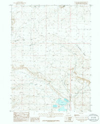
1986 Map of Black Rock South
USGS Topo · Published 1986About this map
The Continental Divide winds through this high desert region of Sweetwater County, marking the hydrological crest between the Atlantic and Pacific watersheds. This 1980s landscape is defined by its arid drainage systems, including the long paths of Deadman Wash, Potash Wash, and Ninemile Wash that cut through the undulating terrain. To the north, the distinctive Black Rock formation and Spring Butte overlook Randor Springs, providing rare water sources in a dry expanse.
Find a feature on this map
12 named features on this map. Tap any name to fly to it.
Don’t see what you’re looking for? This feature index may not catch every label — zoom into the map to look around manually.
Map Details
Editions of this 1986 Black Rock South Map
This is the sole edition of this map. No revisions or reprints were ever made.
Other maps of this area

1954 · Rock Springs
USGS Topo · 1:250,000

1958 · Rock Springs
USGS Topo · 1:250,000

1958 · Twelvemile Well
USGS Topo · 1:62,500

1958 · Superior
USGS Topo · 1:62,500

1962 · Rock Springs
USGS Topo · 1:250,000

1968 · Bitter Creek NW
USGS Topo · 1:24,000

1968 · Point Of Rocks
USGS Topo · 1:24,000
1968 · Thayer Junction
USGS Topo · 1:24,000
1980 · Red Desert Basin
USGS Topo · 1:100,000
1986 · Black Rock Flat West
USGS Topo · 1:24,000