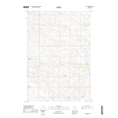
2020 Map of Black Spring
USGS Topo · Published 2020About this map
Indian Coulee and its associated Indian Coulee Spring anchor the southern reaches of this landscape in the Muddy District of Montana. The terrain is defined by a dense network of drainages and coulees that feed into Rosebud Cr, revealing the complex hydrology of the Big Horn and Rosebud county line. Vital water sources like Black Spring and Lynch Spring are intermittent but significant landmarks in this arid environment, often serving as the primary naming conventions for the surrounding landforms. The northern half of the survey is dominated by the multi-branched Cottonwood Creek system, including Little Cottonwood Cr, the N Fork Cottonwood Cr, and the S Fork Cottonwood Cr. This modern survey illustrates how township and range lines like t1s r40e continue to organize this sparsely settled ranching and grazing country.
Find a feature on this map
18 named features on this map. Tap any name to fly to it.
Don’t see what you’re looking for? This feature index may not catch every label — zoom into the map to look around manually.
Map Details
Editions of this 2020 Black Spring Map
This is the sole edition of this map. No revisions or reprints were ever made.
Other maps of this area

1954 · Hardin
USGS Topo · 1:250,000

1957 · Hardin
USGS Topo · 1:250,000

1958 · Hardin
USGS Topo · 1:250,000

1958 · Chalky Point
USGS Topo · 1:24,000

1958 · Painted Hill
USGS Topo · 1:24,000

1958 · Jimtown
USGS Topo · 1:24,000

1958 · Black Spring
USGS Topo · 1:24,000

1958 · Busby
USGS Topo · 1:24,000

1958 · Lame Deer
USGS Topo · 1:24,000

1971 · Colstrip SW
USGS Topo · 1:24,000