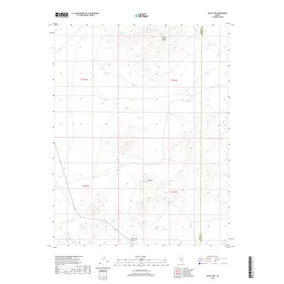
2018 Map of Black Top
USGS Topo · Published 2018About this map
Quinn Canyon Range dominates this corner of the high desert, where steep elevation changes define the landscape of eastern Nye County. The high peaks of Black Top and the prominent Queen City Summit overlook a network of seasonal water sources and catchment points essential for survival in this arid environment. Strategic natural features like Summer Spring, Buck Water Spring, and Neds Cache Spring are marked throughout the terrain, indicating the historical importance of localized water access for travelers and ranchers. Near the center of the southern range, Red Rock Reservoir provides a human-made waypoint. The boundary line for Nye Co Lincoln Co runs along the eastern edge, highlighting the jurisdictional divide in this sparsely populated region of the Great Basin.
Find a feature on this map
12 named features on this map. Tap any name to fly to it.
Don’t see what you’re looking for? This feature index may not catch every label — zoom into the map to look around manually.
Map Details
Editions of this 2018 Black Top Map
This is the sole edition of this map. No revisions or reprints were ever made.
Other maps of this area

1908 · Kawich
USGS Topo · 1:250,000

1942 · Reveille Peak
USGS Topo · 1:125,000

1942 · Penoyer Valley
USGS Topo · 1:125,000

1952 · White Blotch Springs
USGS Topo · 1:62,500

1952 · Reveille Peak
USGS Topo · 1:62,500

1952 · Belted Peak
USGS Topo · 1:62,500

1954 · Caliente
USGS Topo · 1:250,000

1954 · Goldfield
USGS Topo · 1:250,000

1955 · Goldfield
USGS Topo · 1:250,000

1958 · Goldfield
USGS Topo · 1:250,000