2016 Map of Blackburn
USGS Topo · Published 2016About this map
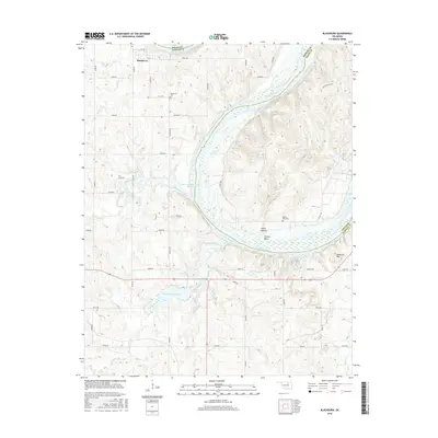
The Arkansas River carves a massive, winding loop through the borderlands of Pawnee and Osage counties, creating a dramatic landscape defined by Souters Bend and Ghost Hollow. This 2016 survey documents the small settlement of Blackburn at the northern edge of the quadrangle, where a regular grid of streets including 1st St and 5th St meets the rural road network. The map reveals a land heavily shaped by water management and local industry, featuring the Cleveland Reservoir and Eck Twin Lakes North Reservoir alongside numerous named creeks such as Hellroaring Creek and Ranch Creek. For genealogists, the map provides precise locations for the Blackburn Cem and Boston Pool Cem, while landmarks like Reservoir Hill offer orientation across the undulating terrain between the river and the northern reaches of the Boston Pool area.
Find a feature on this map
48 named features on this map. Tap any name to fly to it.
Don’t see what you’re looking for? This feature index may not catch every label — zoom into the map to look around manually.
Map Details
Editions of this 2016 Blackburn Map
This is the sole edition of this map. No revisions or reprints were ever made.
Other maps of this area

1912 · Hominy
USGS Topo · 1:125,000

1915 · Hominy
USGS Topo · 1:125,000

1915 · Hominy
USGS Topo · 1:62,500

1929 · Yale
USGS Topo · 1:62,500

1929 · Skedee
USGS Topo · 1:62,500

1931 · Skedee
USGS Topo · 1:62,500

1932 · Yale
USGS Topo · 1:62,500

1955 · Enid
USGS Topo · 1:250,000

1958 · Enid
USGS Topo · 1:250,000

1966 · Cleveland
USGS Topo · 1:24,000