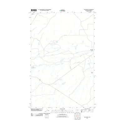
2011 Map of Blackfoot
USGS Topo · Published 2011About this map
The settlement of Blackfoot serves as the focal point for this 2011 survey of Glacier County, Montana. The landscape is defined by the drainage patterns of Flatiron Creek and Willow Creek, which weave through the high plains toward the eastern edge of the quadrangle. In the northwestern corner, Birdrattler Cemetery provides a specific point of interest for genealogists and local historians, sitting near Boarding School Rd. The road network, including Stone Ranch Rd and Arrowtop Rd, reflects the ranching and agricultural orientation of the area. Significant water features such as Aubery Lake and the drainage of Depot Creek mark the open terrain, while Kittson Coulee suggests the deeper topographical relief characteristic of this part of Montana.
Find a feature on this map
14 named features on this map. Tap any name to fly to it.
Don’t see what you’re looking for? This feature index may not catch every label — zoom into the map to look around manually.
Map Details
Editions of this 2011 Blackfoot Map
This is the sole edition of this map. No revisions or reprints were ever made.
Other maps of this area

1901 · Browning
USGS Topo · 1:125,000

1903 · Browning
USGS Topo · 1:125,000

1911 · Blackfoot
USGS Topo · 1:125,000

1913 · Marias Pass
USGS Topo · 1:125,000

1914 · Heart Butte
USGS Topo · 1:125,000

1918 · Heart Butte
USGS Topo · 1:125,000

1960 · Cut Bank
USGS Topo · 1:250,000

1963 · Cut Bank
USGS Topo · 1:250,000

1964 · Cut Bank
USGS Topo · 1:250,000

1968 · Rimrock Butte
USGS Topo · 1:24,000