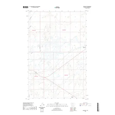
2020 Map of Blackfoot
USGS Topo · Published 2020About this map
Blackfoot serves as the primary settlement within this northern Montana landscape, situated at the intersection of a rail line and the local road network. The terrain is defined by a series of drainages and seasonal wetlands, with Willow Cr and Depot Cr cutting through the central and southern reaches. To the north, Aubery Lake sits as a prominent water feature amid the glacial topography. The naming of local thoroughfares like Boarding School Rd, Arrowtop Rd, and Heart Butte Rd reflects the cultural heritage and administrative history of Glacier County. In the southeast corner, the land drops into the Kittson Coulee, illustrating the erosional patterns common to this high-plains environment near the Rocky Mountain Front. The map highlights a rural infrastructure focused on connectivity between isolated ranchlands and the central hub at Blackfoot.
Find a feature on this map
14 named features on this map. Tap any name to fly to it.
Don’t see what you’re looking for? This feature index may not catch every label — zoom into the map to look around manually.
Map Details
Editions of this 2020 Blackfoot Map
This is the sole edition of this map. No revisions or reprints were ever made.
Other maps of this area

1901 · Browning
USGS Topo · 1:125,000

1903 · Browning
USGS Topo · 1:125,000

1911 · Blackfoot
USGS Topo · 1:125,000

1913 · Marias Pass
USGS Topo · 1:125,000

1914 · Heart Butte
USGS Topo · 1:125,000

1918 · Heart Butte
USGS Topo · 1:125,000

1960 · Cut Bank
USGS Topo · 1:250,000

1963 · Cut Bank
USGS Topo · 1:250,000

1964 · Cut Bank
USGS Topo · 1:250,000

1968 · Rimrock Butte
USGS Topo · 1:24,000