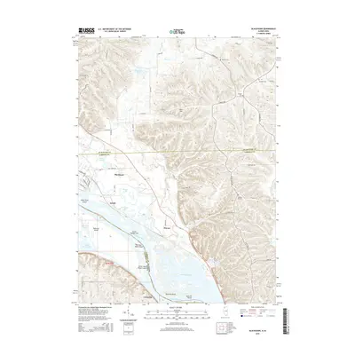
2015 Map of Blackhawk
USGS Topo · Published 2015About this map
The Mississippi River forms the central character of this 2015 survey, defining the border between Carroll County and Jackson County, Iowa. The river's complex backwaters and side channels create a maze of landforms, including Big Soup Bone Island, Little Soup Bone Island, and Railroad Island. Inland, the terrain rises sharply into the bluffs of Derinda Township, where Heer Hill and several local family burial grounds like Morrison Cem and Albright Cem overlook the valley.
Find a feature on this map
64 named features on this map. Tap any name to fly to it.
Don’t see what you’re looking for? This feature index may not catch every label — zoom into the map to look around manually.
Map Details
Editions of this 2015 Blackhawk Map
This is the sole edition of this map. No revisions or reprints were ever made.
Other maps of this area

1892 · Savanna
USGS Topo · 1:62,500

1911 · Elizabeth
USGS Topo · 1:62,500

1911 · Galena
USGS Topo · 1:62,500

1913 · Galena
USGS Topo · 1:62,500

1935 · Miles
USGS Topo · 1:62,500

1936 · Elizabeth
USGS Topo · 1:62,500

1941 · Miles
USGS Topo · 1:62,500

1952 · Savanna
USGS Topo · 1:62,500

1953 · Blackhawk
USGS Topo · 1:24,000

1953 · Green Island
USGS Topo · 1:24,000