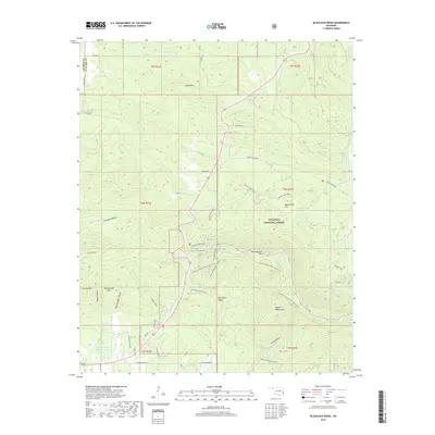
2018 Map of Blackjack Ridge
USGS Topo · Published 2018About this map
Ouachita National Forest covers much of this high-relief landscape in southeastern Oklahoma, dominated by the prominent east-west orientation of the Ouachita Mountains. The terrain is marked by significant peaks and ridges, including Winding Stair Mtn, Buffalo Wallow Mtn, and the titular Blackjack Ridge. These elevations are separated by deep drainages such as Rattlesnake Canyon and Hells Hollow.
Find a feature on this map
53 named features on this map. Tap any name to fly to it.
Don’t see what you’re looking for? This feature index may not catch every label — zoom into the map to look around manually.
Map Details
Editions of this 2018 Blackjack Ridge Map
This is the sole edition of this map. No revisions or reprints were ever made.
Other maps of this area

1900 · Winding Stair
USGS Topo · 1:125,000

1901 · Tuskahoma
USGS Topo · 1:125,000

1908 · Tuskahoma
USGS Topo · 1:125,000

1909 · Tuskahoma
USGS Topo · 1:125,000

1909 · Winding Stair
USGS Topo · 1:125,000

1940 · Red Oak
USGS Topo · 1:62,500

1943 · Red Oak
USGS Topo · 1:62,500

1950 · Mcalester
USGS Topo · 1:250,000

1962 · McAlester
USGS Topo · 1:250,000

1965 · McAlester
USGS Topo · 1:250,000