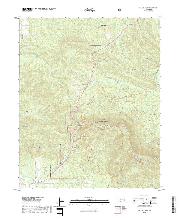
2022 Map of Blackjack Ridge
USGS Topo · Published 2022About this map
The Ouachita National Forest dominates this section of the Le Flore and Latimer county border, where a complex network of ridges and hollows dictates the path of early travel routes and modern recreation. The topographical landscape is defined by significant elevations like Winding Stair Mtn and Buffalo Wallow Mtn, with narrow corridors such as Negro Hollow and Crusher Hollow cutting through the terrain. The presence of the Old Military Road Trl and the Choctaw Nation Trl provides a clear view into the historical transit patterns of the region, tracing paths that predate the modern road system. Water sources like the Flying Ranch Number 1 Reservoir and drainages including Buzzard Cr and Holson Creek highlight the drainage patterns through these mountain gaps. This area remains a crucial intersection of natural resource management and cultural heritage trail systems.
Find a feature on this map
58 named features on this map. Tap any name to fly to it.
Don’t see what you’re looking for? This feature index may not catch every label — zoom into the map to look around manually.
Map Details
Editions of this 2022 Blackjack Ridge Map
This is the sole edition of this map. No revisions or reprints were ever made.
Other maps of this area

1900 · Winding Stair
USGS Topo · 1:125,000

1901 · Tuskahoma
USGS Topo · 1:125,000

1908 · Tuskahoma
USGS Topo · 1:125,000

1909 · Tuskahoma
USGS Topo · 1:125,000

1909 · Winding Stair
USGS Topo · 1:125,000

1940 · Red Oak
USGS Topo · 1:62,500

1943 · Red Oak
USGS Topo · 1:62,500

1950 · Mcalester
USGS Topo · 1:250,000

1962 · McAlester
USGS Topo · 1:250,000

1965 · McAlester
USGS Topo · 1:250,000