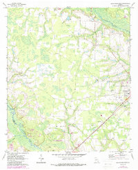
1971 Map of Blackshear West
USGS Topo · Published 1988About this map
The Alabaha River and Satilla River basins converge in this 1970s survey of Pierce County, revealing a landscape defined by its wetlands and rural gathering places. Small community hubs like Jot 'Em Down Store and the settlement of Homestead anchor the agricultural interior, while the western edge of Blackshear appears along the eastern boundary. The map is particularly rich for genealogical research, documenting numerous local houses of worship and burial grounds, including Hacklebarney Ch, Rehobeth Ch, and Youman Chapel. A complex drainage network of creeks like Kettle Creek and Hacklebarney Creek weaves through the terrain, punctuated by extractive sites such as Sandpit and Sandpits, which suggest the local industry of the era. This edition includes 1980s photorevisions, which help track the modest growth of infrastructure and the introduction of new landmarks like the Radio Towers and Golf Course.
Find a feature on this map
25 named features on this map. Tap any name to fly to it.
Don’t see what you’re looking for? This feature index may not catch every label — zoom into the map to look around manually.
Map Details
Editions of this 1971 Blackshear West Map
2 editions found
Other maps of this area

1953 · Waycross
USGS Topo · 1:250,000

1958 · Waycross
USGS Topo · 1:250,000

1967 · Hoboken West
USGS Topo · 1:24,000

1967 · Waycross West
USGS Topo · 1:24,000

1967 · Waycross East
USGS Topo · 1:24,000

1971 · Dixie Union
USGS Topo · 1:24,000

1971 · Blackshear East
USGS Topo · 1:24,000

1971 · Patterson
USGS Topo · 1:24,000

1971 · Blackshear West
USGS Topo · 1:24,000

1971 · Mershon
USGS Topo · 1:24,000