
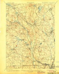
1900 Map of Blackstone
USGS Topo · Published 1942About this map
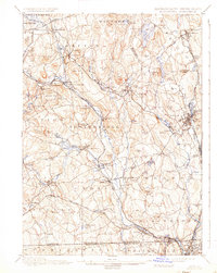
The Blackstone River serves as the industrial spine of this region, its waters fueling a dense network of mill towns and manufacturing centers at the turn of the century. From the sprawling village of Whitinsville to the rail hubs of Uxbridge and Blackstone, the landscape reflects a late-19th-century economy deeply integrated with water power and the Providence and Worcester R.R.. This survey, conducted primarily in 1886, reveals the intricate layout of numerous mill villages such as Fisherville, Farnumsville, and Saundersville clustered along the riverbanks.
Find a feature on this map
117 named features on this map. Tap any name to fly to it.
Don’t see what you’re looking for? This feature index may not catch every label — zoom into the map to look around manually.
Map Details
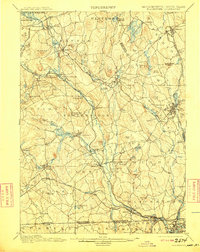
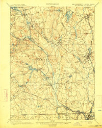
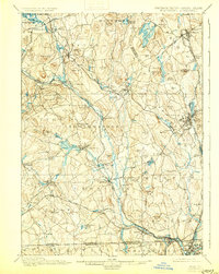
Editions of this 1900 Blackstone Map
7 editions found

Other maps of this area

1885 · Worcester
USGS Topo · 1:62,500

1886 · Worcester
USGS Topo · 1:62,500

1886 · Blackstone
USGS Topo · 1:62,500

1886 · Framingham
USGS Topo · 1:62,500

1887 · Franklin
USGS Topo · 1:62,500

1887 · Providence
USGS Topo · 1:62,500

1887 · Marlboro
USGS Topo · 1:62,500

1889 · Providence
USGS Topo · 1:62,500

1889 · Marlboro
USGS Topo · 1:62,500

1889 · Blackstone
USGS Topo · 1:62,500