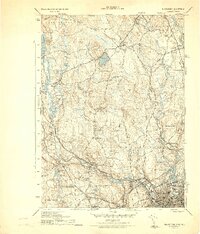
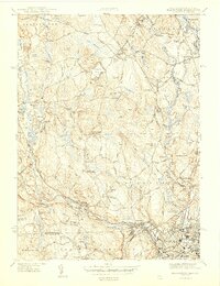
1944 Map of Blackstone
USGS Topo · Published 1944About this map
The industrial and agricultural landscape of the Blackstone River valley is documented here just before the mid-century. The river network, including the Mumford River, Peters River, and Mill River, supported a dense collection of mill-related settlements such as Wheelockville, Spindleville, and Millville. The presence of the New York New Haven and Hartford Railroad highlights the transportation corridor that linked these textile and manufacturing centers.
Find a feature on this map
80 named features on this map. Tap any name to fly to it.
Don’t see what you’re looking for? This feature index may not catch every label — zoom into the map to look around manually.
Map Details
Editions of this 1944 Blackstone Map
5 editions found
Other maps of this area

1886 · Blackstone
USGS Topo · 1:62,500

1887 · Franklin
USGS Topo · 1:62,500

1887 · Providence
USGS Topo · 1:62,500

1889 · Providence
USGS Topo · 1:62,500

1889 · Blackstone
USGS Topo · 1:62,500

1889 · Franklin
USGS Topo · 1:62,500

1889 · Burrillville
USGS Topo · 1:62,500

1893 · Franklin
USGS Topo · 1:62,500

1893 · Blackstone
USGS Topo · 1:62,500

1894 · Burrillville
USGS Topo · 1:62,500