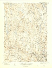
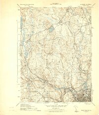
1944 Map of Blackstone
USGS Topo · Published 1944About this map
The Blackstone River and the New York New Haven and Hartford RR corridor anchor this mid-century portrait of the industrial borderlands between Massachusetts and Rhode Island. This survey reveals a landscape of mill towns and crossroads communities, from the dense grid of Woonsocket in the south to the outlying clusters of Millville and Blackstone. Local civic life is well-documented through landmarks like the Chestnut Hill Meeting House, Elmdale Sch, and the Chestnut Hill Fire Lookout atop the central ridges. The map identifies numerous specialized burial grounds, including St Michaels Ukrainian Cem and Precious Blood Cem, reflecting the diverse immigrant heritage of the Blackstone Valley's manufacturing workforce. Early aviation infrastructure also appears on the heights, marked by the Mendon Landing Field and a nearby Airway Beacon.
Find a feature on this map
88 named features on this map. Tap any name to fly to it.
Don’t see what you’re looking for? This feature index may not catch every label — zoom into the map to look around manually.
Map Details
Editions of this 1944 Blackstone Map
5 editions found
Other maps of this area

1886 · Blackstone
USGS Topo · 1:62,500

1887 · Franklin
USGS Topo · 1:62,500

1887 · Providence
USGS Topo · 1:62,500

1889 · Providence
USGS Topo · 1:62,500

1889 · Blackstone
USGS Topo · 1:62,500

1889 · Franklin
USGS Topo · 1:62,500

1889 · Burrillville
USGS Topo · 1:62,500

1893 · Franklin
USGS Topo · 1:62,500

1893 · Blackstone
USGS Topo · 1:62,500

1894 · Burrillville
USGS Topo · 1:62,500