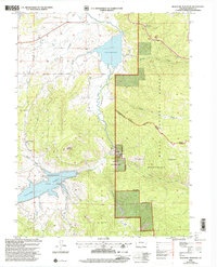
2000 Map of Blacktail Mountain
USGS Topo · Published 2004About this map
Lake Catamount and the Yampa River corridor anchor this high-elevation landscape in Routt National Forest. The map documents a significant era of water management and recreation, highlighted by the presence of Stagecoach Reservoir and the surrounding Stagecoach State Park. The terrain is defined by the steep rises of Blacktail Mountain and Woodchuck Hill, with drainage provided by a network of creeks including Harrison Creek, Green Creek, and Morrison Creek.
Find a feature on this map
26 named features on this map. Tap any name to fly to it.
Don’t see what you’re looking for? This feature index may not catch every label — zoom into the map to look around manually.
Map Details
Editions of this 2000 Blacktail Mountain Map
This is the sole edition of this map. No revisions or reprints were ever made.
Other maps of this area

1954 · Craig
USGS Topo · 1:250,000

1956 · Storm Mountain
USGS Topo · 1:24,000

1956 · Walton Peak
USGS Topo · 1:24,000

1956 · Gore Pass
USGS Topo · 1:62,500

1956 · Rabbit Ears Peak
USGS Topo · 1:62,500

1957 · Craig
USGS Topo · 1:250,000

1958 · Craig
USGS Topo · 1:250,000

1960 · Craig
USGS Topo · 1:250,000

1962 · Craig
USGS Topo · 1:250,000

1964 · Craig
USGS Topo · 1:250,000