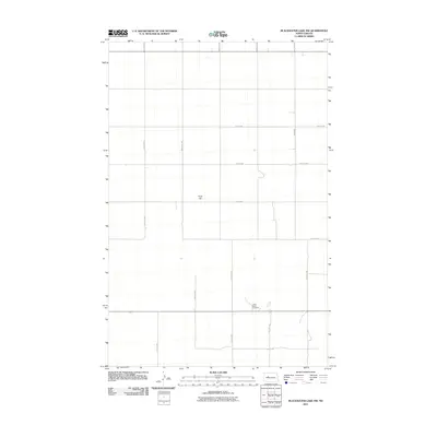
2011 Map of Blackwater Lake NW
USGS Topo · Published 2011About this map
The Indian Scout Cemetery provides a significant focal point for genealogical and cultural research in this section of McLean County. This 2011 survey documents a sparsely populated rural landscape defined by an orderly grid of section roads, including 15th St NW and 67th Ave NW, which partition the open terrain. One of the few prominent landforms noted is Paint Hill, which breaks the otherwise consistent topography. The map illustrates a contemporary rural infrastructure where large-scale land divisions and local access roads like 18th St NW and 61st Ave NW facilitate movement through the agricultural and tribal lands of the region.
Find a feature on this map
13 named features on this map. Tap any name to fly to it.
Don’t see what you’re looking for? This feature index may not catch every label — zoom into the map to look around manually.
Map Details
Editions of this 2011 Blackwater Lake NW Map
This is the sole edition of this map. No revisions or reprints were ever made.
Other maps of this area

1953 · Watford City
USGS Topo · 1:250,000

1954 · McClusky
USGS Topo · 1:250,000

1956 · Makoti SW
USGS Topo · 1:24,000

1956 · Blackwater Lake NW
USGS Topo · 1:24,000

1956 · Blackwater Lake
USGS Topo · 1:24,000

1956 · Roseglen
USGS Topo · 1:24,000

1957 · Watford City
USGS Topo · 1:250,000

1958 · McClusky
USGS Topo · 1:250,000

1967 · Watford City
USGS Topo · 1:250,000

1967 · Blackwater Lake SE
USGS Topo · 1:24,000