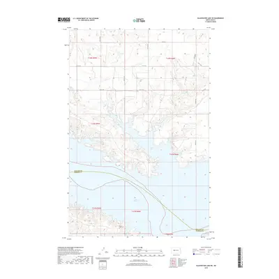
2018 Map of Blackwater Lake SW
USGS Topo · Published 2018About this map
Lake Sakakawea dominates this landscape on the border of Mercer and McLean counties, where the Missouri River valley was transformed into a massive reservoir. The intricate shoreline of the lake reaches north into Nishu Bay and follows the winding path of Sixmile Cr. On the southern uplands near the county boundary, the Beaver Creek Cem remains a localized historical marker amidst a grid of rural section roads like 12th St NW and 65th Ave NW. This survey reflects the modern configuration of the reservoir, illustrating how the rising waters redefined the regional geography and isolated formerly contiguous landforms into peninsulas and deep-water inlets.
Find a feature on this map
17 named features on this map. Tap any name to fly to it.
Don’t see what you’re looking for? This feature index may not catch every label — zoom into the map to look around manually.
Map Details
Editions of this 2018 Blackwater Lake SW Map
This is the sole edition of this map. No revisions or reprints were ever made.
Other maps of this area

1953 · Watford City
USGS Topo · 1:250,000

1954 · McClusky
USGS Topo · 1:250,000

1956 · Blackwater Lake NW
USGS Topo · 1:24,000

1956 · Blackwater Lake
USGS Topo · 1:24,000

1957 · Watford City
USGS Topo · 1:250,000

1958 · McClusky
USGS Topo · 1:250,000

1967 · Watford City
USGS Topo · 1:250,000

1967 · Blackwater Lake SE
USGS Topo · 1:24,000

1967 · Raub SE
USGS Topo · 1:24,000

1967 · Raub
USGS Topo · 1:24,000