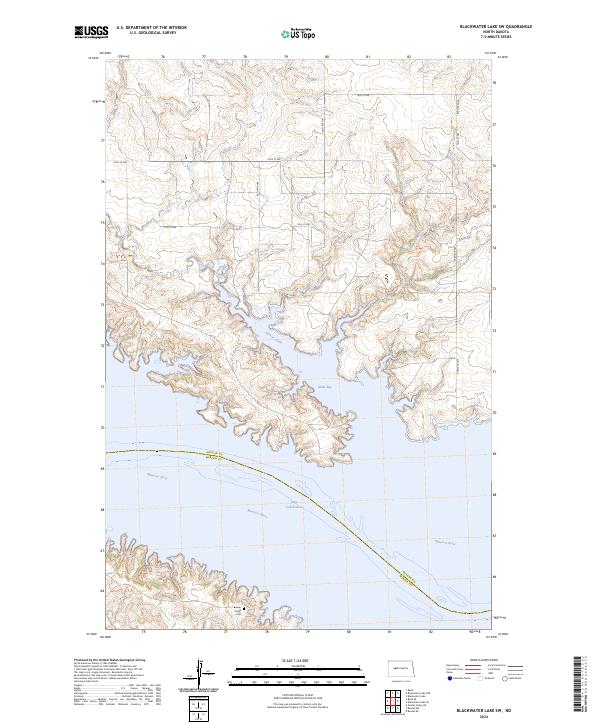
2024 Map of Blackwater Lake SW
USGS Topo · Published 2024About this map
Lake Sakakawea dominates the southern landscape of this McLean County region, where the reservoir waters have reshaped the historic drainage of the Missouri River. The map illustrates the complex shoreline formed by flooded coulees, most notably at Nishu Bay and where Sixmile Creek enters the lake from the north. The terrain transition is sharp between the high, gridded upland prairies, marked by rural routes like 67th Ave NW and 14th St NW, and the low-lying wetlands of the river valley. For those researching local burial sites and family heritage, the Beaver Creek Cem is situated in the southwestern portion of the quadrangle near the boundary of Mercer County, serving as a permanent landmark in a landscape significantly altered by mid-century water management projects.
Find a feature on this map
18 named features on this map. Tap any name to fly to it.
Don’t see what you’re looking for? This feature index may not catch every label — zoom into the map to look around manually.
Map Details
Editions of this 2024 Blackwater Lake SW Map
This is the sole edition of this map. No revisions or reprints were ever made.
Other maps of this area

1953 · Watford City
USGS Topo · 1:250,000

1954 · McClusky
USGS Topo · 1:250,000

1956 · Blackwater Lake NW
USGS Topo · 1:24,000

1956 · Blackwater Lake
USGS Topo · 1:24,000

1957 · Watford City
USGS Topo · 1:250,000

1958 · McClusky
USGS Topo · 1:250,000

1967 · Watford City
USGS Topo · 1:250,000

1967 · Blackwater Lake SE
USGS Topo · 1:24,000

1967 · Raub SE
USGS Topo · 1:24,000

1967 · Raub
USGS Topo · 1:24,000