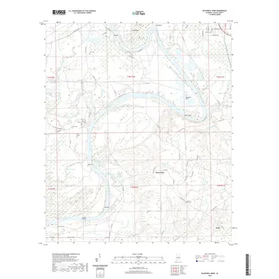
2020 Map of Blackwell Bend
USGS Topo · Published 2020About this map
The Alabama River and Cahaba River converge in this section of Dallas County, creating a landscape defined by dramatic meanders and alluvial bars. The settlement of Berlin sits in the southeast, while Mount Nebo occupies the central uplands. For genealogists, the map is particularly dense with burial sites, including Adams Grove Cem, Matthew Cem, and Henry Cem. The terrain is marked by significant river features like Blackwell Bend, Kings Bend, and Hatcher Bluff. Numerous tributaries such as Mush Cr and Steen Cr drain into the river system, which includes prominent navigation points like Turkey Ford Bar and Cade Bar. This survey provides a modern view of the road networks, including Co RD 124 and Co RD 26, as they traverse the wetlands of Cypress Pond.
Find a feature on this map
86 named features on this map. Tap any name to fly to it.
Don’t see what you’re looking for? This feature index may not catch every label — zoom into the map to look around manually.
Map Details
Editions of this 2020 Blackwell Bend Map
This is the sole edition of this map. No revisions or reprints were ever made.
Other maps of this area

1953 · Montgomery
USGS Topo · 1:250,000

1956 · Montgomery
USGS Topo · 1:250,000

1957 · Montgomery
USGS Topo · 1:250,000

1957 · Carlowville
USGS Topo · 1:62,500

1957 · Benton
USGS Topo · 1:62,500

1957 · Braggs
USGS Topo · 1:62,500

1958 · Selma
USGS Topo · 1:62,500

1958 · Selma
USGS Topo · 1:24,000

1975 · Selma NW
USGS Topo · 1:24,000

1975 · Selma SE
USGS Topo · 1:24,000