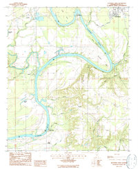
1987 Map of Blackwell Bend
USGS Topo · Published 1987About this map
The confluence of the Cahaba River and the Alabama River anchors this landscape in Dallas County, Alabama. The river geography is defined by significant meanders like Kings Bend and Blackwell Bend, where the water has carved dramatic features such as Hatcher Bluff. Along the eastern banks, the residential area of West Selmont contrasts with the more dispersed rural settlements like Berlin and the historic site of Cahaba.
Find a feature on this map
34 named features on this map. Tap any name to fly to it.
Don’t see what you’re looking for? This feature index may not catch every label — zoom into the map to look around manually.
Map Details
Editions of this 1987 Blackwell Bend Map
This is the sole edition of this map. No revisions or reprints were ever made.
Other maps of this area

1953 · Montgomery
USGS Topo · 1:250,000

1956 · Montgomery
USGS Topo · 1:250,000

1957 · Montgomery
USGS Topo · 1:250,000

1957 · Carlowville
USGS Topo · 1:62,500

1957 · Benton
USGS Topo · 1:62,500

1957 · Braggs
USGS Topo · 1:62,500

1958 · Selma
USGS Topo · 1:62,500

1958 · Selma
USGS Topo · 1:24,000

1975 · Selma NW
USGS Topo · 1:24,000

1975 · Selma SE
USGS Topo · 1:24,000