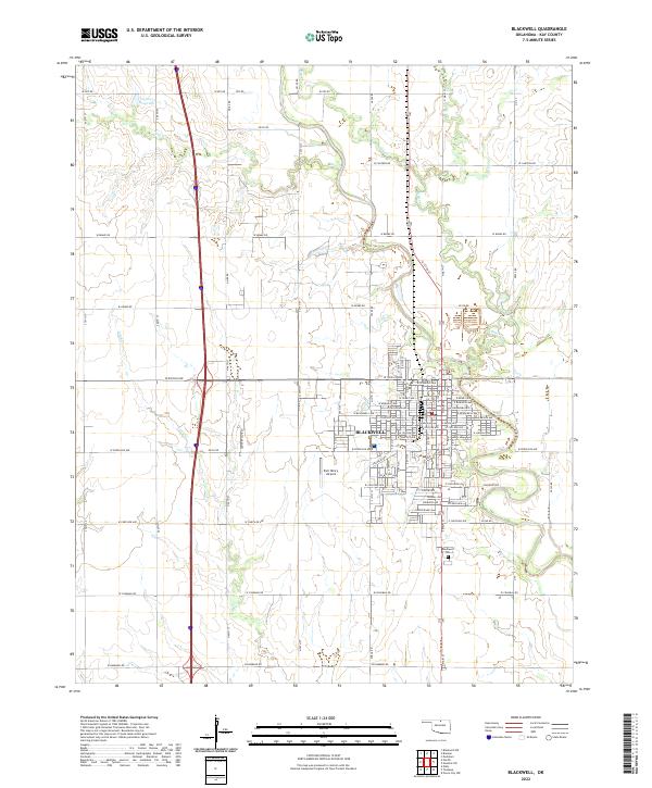
2022 Map of Blackwell
USGS Topo · Published 2022About this map
Blackwell serves as the central hub of this northern Oklahoma survey, situated amidst a landscape carved by the meandering courses of Bitter Cr and Stink Cr. The city's grid is well-defined, transitioning from residential streets like W Florence Ave and E Dewey Ave to the industrial and transportation infrastructure on its periphery. The presence of the Earl Henry Airport to the west and the Blackwell Cem to the south provides clear landmarks for local history and genealogical research.
Find a feature on this map
56 named features on this map. Tap any name to fly to it.
Don’t see what you’re looking for? This feature index may not catch every label — zoom into the map to look around manually.
Map Details
Editions of this 2022 Blackwell Map
This is the sole edition of this map. No revisions or reprints were ever made.
Other maps of this area

1955 · Enid
USGS Topo · 1:250,000

1958 · Enid
USGS Topo · 1:250,000

1967 · Braman
USGS Topo · 1:24,000

1968 · Ponca City NW
USGS Topo · 1:24,000

1968 · Eddy
USGS Topo · 1:24,000

1968 · Blackwell NW
USGS Topo · 1:24,000

1968 · Nardin
USGS Topo · 1:24,000

1968 · Tonkawa
USGS Topo · 1:24,000

1968 · Blackwell
USGS Topo · 1:24,000
1968 · Newkirk SW
USGS Topo · 1:24,000