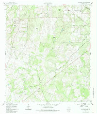
1960 Map of Blackwell Lake
USGS Topo · Published 1985About this map
Mustang Mott serves as a central point in this rural DeWitt County landscape, characterized by a network of ranching properties and small-scale commerce. The map documents numerous named holdings including the Warzecha Ranch, Shows Ranch, and Lippke Ranch, alongside local gathering spots like the Mustang Mott Store and Kubala Store. These family-named landmarks suggest a deeply rooted agricultural community tied to the land's drainage systems, with Clear Creek, Cottonwood Creek, and Shiloh Creek carving through the terrain.
Find a feature on this map
26 named features on this map. Tap any name to fly to it.
Don’t see what you’re looking for? This feature index may not catch every label — zoom into the map to look around manually.
Map Details
Editions of this 1960 Blackwell Lake Map
3 editions found
Other maps of this area

1920 · Smiley
USGS Topo · 1:125,000

1953 · Beeville
USGS Topo · 1:250,000

1953 · Seguin
USGS Topo · 1:250,000

1956 · Beeville
USGS Topo · 1:250,000

1958 · Seguin
USGS Topo · 1:250,000

1960 · Beeville
USGS Topo · 1:250,000

1960 · Cuero
USGS Topo · 1:24,000

1960 · Concrete
USGS Topo · 1:24,000

1960 · Blackwell Lake
USGS Topo · 1:24,000

1960 · Westhoff
USGS Topo · 1:24,000