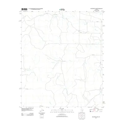
2012 Map of Blackwell SW
USGS Topo · Published 2012About this map
Large cattle operations like White Hall Ranch and Whiteside Ranch define the settlement pattern of this West Texas landscape. The drainage network is dense and varied, with Antelope Cr running across the northern section while Bouzier Cr and Mountain Cr carve through the central and southern reaches. A network of county roads and ranch-access routes, including Hamilton Rd and Austin Ranch Rd, provide the primary infrastructure for this ranching territory. The map shows the land as it was surveyed in the early 21st century, illustrating how established watercourses like Gobbler Cr and Eagle Cr continue to anchor the geographic identity of this rural expanse.
Find a feature on this map
20 named features on this map. Tap any name to fly to it.
Don’t see what you’re looking for? This feature index may not catch every label — zoom into the map to look around manually.
Map Details
Editions of this 2012 Blackwell SW Map
This is the sole edition of this map. No revisions or reprints were ever made.
Other maps of this area

1891 · Hayrick
USGS Topo · 1:125,000

1893 · Sweetwater
USGS Topo · 1:125,000

1894 · Hayrick
USGS Topo · 1:125,000

1921 · Bronte
USGS Topo · 1:31,680

1954 · Big Spring
USGS Topo · 1:250,000

1954 · San Angelo
USGS Topo · 1:250,000

1958 · San Angelo
USGS Topo · 1:250,000

1958 · Big Spring
USGS Topo · 1:250,000
1961 · Bronte
USGS Topo · 1:24,000

1962 · Edith
USGS Topo · 1:24,000