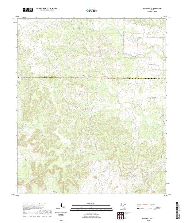
2022 Map of Blackwell SW
USGS Topo · Published 2022About this map
Nolan Co Coke Co boundary lines bisect this West Texas landscape, where the terrain is defined by a dense network of seasonal drainage channels cutting through the plateau. Waterways like Antelope Cr and Eagle Cr in the north, alongside Bouzier Cr and Mountain Cr further south, illustrate the erosion patterns characteristic of this region. The absence of concentrated town centers suggests a land primarily dedicated to large-scale ranching and resource management.
Find a feature on this map
17 named features on this map. Tap any name to fly to it.
Don’t see what you’re looking for? This feature index may not catch every label — zoom into the map to look around manually.
Map Details
Editions of this 2022 Blackwell SW Map
This is the sole edition of this map. No revisions or reprints were ever made.
Other maps of this area

1891 · Hayrick
USGS Topo · 1:125,000

1893 · Sweetwater
USGS Topo · 1:125,000

1894 · Hayrick
USGS Topo · 1:125,000

1921 · Bronte
USGS Topo · 1:31,680

1954 · Big Spring
USGS Topo · 1:250,000

1954 · San Angelo
USGS Topo · 1:250,000

1958 · San Angelo
USGS Topo · 1:250,000

1958 · Big Spring
USGS Topo · 1:250,000
1961 · Bronte
USGS Topo · 1:24,000

1962 · Edith
USGS Topo · 1:24,000