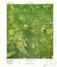
1980 Map of Bladen
USGS Topo · Published 1980About this map
Turtle River and its intricate network of surrounding swamps define this coastal Georgia landscape near the border of Glynn and Camden Counties. The map reveals a region shaped by maritime timber and transit, where historic routes like Tram Road and Shingle Mill Road suggest an era of industrial logging. Small settlements such as Bladen, Georgetown, and Brookman are dispersed throughout the low-lying terrain, connected by the prominent Seaboard Coast Line railroad.
Find a feature on this map
47 named features on this map. Tap any name to fly to it.
Don’t see what you’re looking for? This feature index may not catch every label — zoom into the map to look around manually.
Map Details
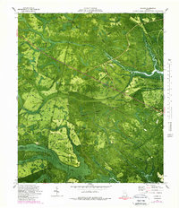
Editions of this 1980 Bladen Map
2 editions found
Other maps of this area

1917 · Nahunta
USGS Topo · 1:62,500

1918 · Hortense
USGS Topo · 1:62,500

1918 · Everett City
USGS Topo · 1:62,500

1918 · Nahunta
USGS Topo · 1:62,500

1918 · Bladen
USGS Topo · 1:62,500

1920 · Everett City
USGS Topo · 1:62,500

1939 · Bladen
USGS Topo · 1:62,500

1944 · Everett City
USGS Topo · 1:62,500

1944 · Hortense
USGS Topo · 1:62,500

1946 · Brunswick
USGS Topo · 1:250,000