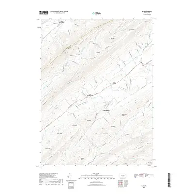
2019 Map of Blain
USGS Topo · Published 2019About this map
New Germantown and Blain anchor this survey of the high ridges and deep valleys along the Juniata Co Perry Co line. The landscape is defined by the sharp parallel crests of the Appalachian ridge-and-valley system, notably Tuscarora Mtn and Conococheague Mtn. Between these heights, agriculture and small settlements like Mount Pleasant and Center Square follow the path of Shermans Cr. This region maintains a traditional rural character, where local roads like Big Spring Rd and Germantown Rd connect historic burial grounds such as Eby Cem and Blain Cem. The map reveals how the terrain dictates human movement, funneling travel through points like Little Gap and Winns Gap while preserving secluded areas such as Horse Valley and Kansas Valley.
Find a feature on this map
93 named features on this map. Tap any name to fly to it.
Don’t see what you’re looking for? This feature index may not catch every label — zoom into the map to look around manually.
Map Details
Editions of this 2019 Blain Map
This is the sole edition of this map. No revisions or reprints were ever made.
Other maps of this area

1919 · Newville
USGS Topo · 1:62,500

1919 · Mattawana
USGS Topo · 1:62,500

1923 · Shippensburg
USGS Topo · 1:62,500

1930 · Loysville
USGS Topo · 1:62,500

1933 · Loysville
USGS Topo · 1:62,500

1936 · East Waterford
USGS Topo · 1:48,000

1941 · East Waterford
USGS Topo · 1:62,500

1943 · Shippensburg
USGS Topo · 1:62,500

1945 · Newville
USGS Topo · 1:62,500

1945 · Shippensburg
USGS Topo · 1:62,500
Featured Places
- Blain, PA
- Jackson Township, PA
- Southwest Madison Township, PA
- Mount Pleasant, Jackson Township
- Lack Township, PA