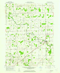
1960 Map of Blaine
USGS Topo · Published 1961About this map
The Salamonie River cuts through this rural landscape in Jay County, anchoring a network of small agricultural settlements and family-named landmarks. The hamlet of Blaine serves as a central point along the New York Chicago and St Louis Railroad, which parallels Blaine Run to the southeast. This 1960 field check reveals a community defined by its local institutions, including Sugar Grove Ch, Hopewell Ch, and Walnut Corner Ch, each serving its respective corner of the township.
Find a feature on this map
59 named features on this map. Tap any name to fly to it.
Don’t see what you’re looking for? This feature index may not catch every label — zoom into the map to look around manually.
Map Details
Editions of this 1960 Blaine Map
3 editions found
Other maps of this area

1911 · Berne
USGS Topo · 1:48,000

1915 · Fort Recovery
USGS Topo · 1:48,000

1918 · Fort Recovery
USGS Topo · 1:62,500

1953 · Muncie
USGS Topo · 1:250,000

1956 · Muncie
USGS Topo · 1:250,000

1960 · Pennville
USGS Topo · 1:24,000

1960 · Blaine
USGS Topo · 1:24,000
1960 · Portland
USGS Topo · 1:24,000

1960 · Ridgeville
USGS Topo · 1:24,000
1960 · Deerfield
USGS Topo · 1:24,000