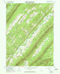
1960 Map of Blairs Mills
USGS Topo · Published 1972About this map
Tuscarora Mountain and Shade Mountain dominate this Central Pennsylvania landscape, creating a series of narrow, parallel valleys defined by the ridge-and-valley province. The eponymous settlement of Blairs Mills sits at the western foot of the mountain range, where Tuscarora Creek winds through the narrow gaps. This 1960s era view, with 1971 updates, reveals a rural network of small communities and family-named landmarks such as Spears Grove and Peru Mills. The map details the transition from forested ridges of the Tuscarora State Forest to the small-scale agricultural clearings in Shade Valley. Of particular interest to genealogists are the rural churches and burial grounds, including Zion Ch, McCabe Chapel, and the McWilliams Cem near Perulack. Multiple pipelines cut across the ridges, and a Jeep Trail provides access to the high ground near Big Round Top.
Find a feature on this map
55 named features on this map. Tap any name to fly to it.
Don’t see what you’re looking for? This feature index may not catch every label — zoom into the map to look around manually.
Map Details
Editions of this 1960 Blairs Mills Map
2 editions found
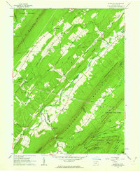
Other maps of this area

1919 · Mattawana
USGS Topo · 1:62,500

1922 · Mt Union
USGS Topo · 1:48,000

1923 · Shippensburg
USGS Topo · 1:62,500

1924 · Mt. Union
USGS Topo · 1:62,500

1936 · East Waterford
USGS Topo · 1:48,000

1939 · Orbisonia
USGS Topo · 1:62,500

1940 · Orbisonia
USGS Topo · 1:62,500

1941 · East Waterford
USGS Topo · 1:62,500

1943 · Shippensburg
USGS Topo · 1:62,500

1944 · Orbisonia
USGS Topo · 1:62,500
Featured Places
- Blairs Mills, Tell Township
- Lack Township, PA
- Tell Township, PA
- Perulack, Lack Township
- Spears Grove, Lack Township