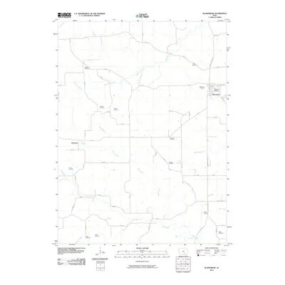
2010 Map of Blakesburg
USGS Topo · Published 2010About this map
The town of Blakesburg serves as the primary hub in this corner of Wapello County, anchored by the Blakesburg Post Office and its grid of residential streets. The surrounding landscape is defined by the winding paths of South Avery Creek and Soap Creek, which carve through the rural countryside. For genealogists, this map is an exceptional resource, documenting over ten distinct burial grounds scattered across the townships, including Caldwell Cemetery, Eslinger Cemetery, and Hough Cemetery. Smaller settlements such as Brompton appear alongside a network of rural roads like Bluegrass Rd and Monroe Wapello Rd, illustrating the persistence of established land divisions and family-named landmarks. The terrain is a network of small tributaries, such as Boyd Branch and Little Soap Creek, which intersect the agricultural fields and woodlots that characterize this Iowa interior.
Find a feature on this map
63 named features on this map. Tap any name to fly to it.
Don’t see what you’re looking for? This feature index may not catch every label — zoom into the map to look around manually.
Map Details
Editions of this 2010 Blakesburg Map
This is the sole edition of this map. No revisions or reprints were ever made.
Other maps of this area

1929 · Albia
USGS Topo · 1:62,500

1939 · Mystic
USGS Topo · 1:62,500

1942 · Mystic
USGS Topo · 1:62,500

1954 · Centerville
USGS Topo · 1:250,000

1954 · Des Moines
USGS Topo · 1:250,000

1956 · Des Moines
USGS Topo · 1:250,000

1957 · Des Moines
USGS Topo · 1:250,000

1957 · Centerville
USGS Topo · 1:250,000

1958 · Centerville
USGS Topo · 1:250,000

1966 · Hiattsville
USGS Topo · 1:24,000