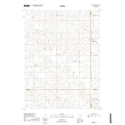
2018 Map of Blakesburg
USGS Topo · Published 2018About this map
Blakesburg serves as the primary hub in this corner of Southern Iowa, where the borders of Monroe, Wapello, Appanoose, and Davis counties converge. The landscape is defined by the winding drainages of Soap Cr and Little Soap Cr, which carve through the terrain and influence the placement of the local road network. Genealogists will find this sheet particularly valuable for its density of rural burial grounds, ranging from Blakesburg Cem near the town center to more isolated sites like Albany Cem, Kipnart Cem, and Knapp Cem. The settlement at Brompton further illustrates the scattered community patterns of the region. The map documents the persistent agricultural and rural character of the area, punctuated by small-scale features like the Bison Trl and the crossing of Mormon Cr, reflecting the long-standing history of migration and settlement in this multi-county junction.
Find a feature on this map
59 named features on this map. Tap any name to fly to it.
Don’t see what you’re looking for? This feature index may not catch every label — zoom into the map to look around manually.
Map Details
Editions of this 2018 Blakesburg Map
This is the sole edition of this map. No revisions or reprints were ever made.
Other maps of this area

1929 · Albia
USGS Topo · 1:62,500

1939 · Mystic
USGS Topo · 1:62,500

1942 · Mystic
USGS Topo · 1:62,500

1954 · Centerville
USGS Topo · 1:250,000

1954 · Des Moines
USGS Topo · 1:250,000

1956 · Des Moines
USGS Topo · 1:250,000

1957 · Des Moines
USGS Topo · 1:250,000

1957 · Centerville
USGS Topo · 1:250,000

1958 · Centerville
USGS Topo · 1:250,000

1966 · Hiattsville
USGS Topo · 1:24,000