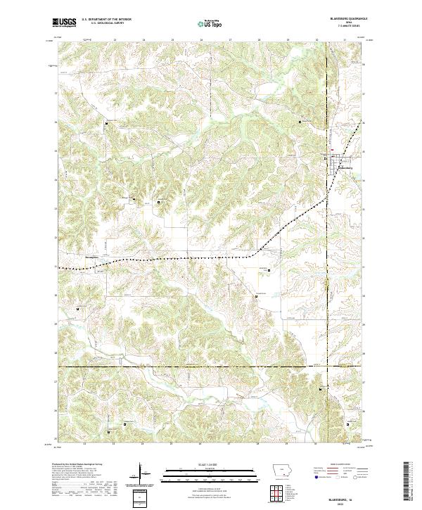
2022 Map of Blakesburg
USGS Topo · Published 2022About this map
Blakesburg sits at the intersection of several county boundaries, serving as a hub for the agricultural landscape of Wapello and Monroe counties. The terrain is defined by a dense network of drainage, where Little Soap Cr and Soap Cr carve through the southern reaches of the quadrangle. For genealogists and local historians, this map is particularly dense with burial sites, showing locations for the Caldwell Cem, Kipnart Cem, and Eslinger Cem among many others. The settlement at Brompton further illustrates the dispersed nature of these rural communities. Large creek systems like Mormon Cr and Buzzard Cr dictate the layout of secondary roads and local connectors such as Co Rd H49, reflecting a landscape where geography heavily influences the transportation grid.
Find a feature on this map
78 named features on this map. Tap any name to fly to it.
Don’t see what you’re looking for? This feature index may not catch every label — zoom into the map to look around manually.
Map Details
Editions of this 2022 Blakesburg Map
This is the sole edition of this map. No revisions or reprints were ever made.
Other maps of this area

1929 · Albia
USGS Topo · 1:62,500

1939 · Mystic
USGS Topo · 1:62,500

1942 · Mystic
USGS Topo · 1:62,500

1954 · Centerville
USGS Topo · 1:250,000

1954 · Des Moines
USGS Topo · 1:250,000

1956 · Des Moines
USGS Topo · 1:250,000

1957 · Des Moines
USGS Topo · 1:250,000

1957 · Centerville
USGS Topo · 1:250,000

1958 · Centerville
USGS Topo · 1:250,000

1966 · Hiattsville
USGS Topo · 1:24,000