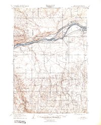
1908 Map of Blalock Island
USGS Topo · Published 1944About this map
Columbia River shoreline life at the turn of the century is defined by the competing interests of rail and river commerce. This survey shows the Spokane Portland and Seattle railroad hugging the northern bank through Paterson, while the Union Pacific line follows the southern bank through Castle Rock and Carley. Inland from the river, the landscape of Morrow and Gilliam counties is dotted with early 20th-century outposts like Ella, Cecil, and Morgan, connected by an established Oregon trail system that pre-dates modern highway infrastructure. The map preserves the original geography of the river valley before mid-century dam projects, documenting significant landforms such as Blalock Island and the distinctive Canoe Ridge. Numerous natural springs, including Sunberry Spr and McDade Spr, highlight the critical water sources that supported early cattle ranching and homesteading in this arid corridor.
Find a feature on this map
45 named features on this map. Tap any name to fly to it.
Don’t see what you’re looking for? This feature index may not catch every label — zoom into the map to look around manually.
Map Details
Editions of this 1908 Blalock Island Map
3 editions found
Other maps of this area

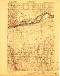
1906 · Blalock Island
USGS Topo · 1:125,000

1908 · Blalock Island
USGS Topo · 1:125,000

1908 · Umatilla
USGS Topo · 1:125,000

1910 · Zillah
USGS Topo · 1:125,000

1915 · Prosser
USGS Topo · 1:125,000

1916 · Arlington
USGS Topo · 1:125,000

1916 · Condon
USGS Topo · 1:125,000

1917 · Pasco
USGS Topo · 1:125,000

1917 · Prosser
USGS Topo · 1:125,000

1950 · Yakima
USGS Topo · 1:250,000