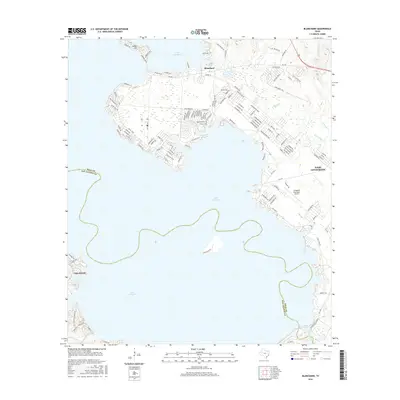
2016 Map of Blanchard
USGS Topo · Published 2016About this map
Lake Livingston dominates this portion of East Texas, where the reservoir waters meet the dense piney woods at the Polk and San Jacinto County line. The settlement of Blanchard sits near the northern shoreline, connected to surrounding communities by FM 2457 and FM 3277. The map illustrates a landscape of residential development woven into the shoreline, including the communities of Cape Royale and Indian Hill, as well as the larger population center at West Livingston. Along the eastern edge, the Livingston Municipal Airport serves as a modern transportation hub, while natural drainage persists through W Tempe Creek and E Tempe Creek. This survey captures the complex intersection of recreational lake life and established timber-country settlements as they appeared in the mid-2010s.
Find a feature on this map
122 named features on this map. Tap any name to fly to it.
Don’t see what you’re looking for? This feature index may not catch every label — zoom into the map to look around manually.
Map Details
Editions of this 2016 Blanchard Map
This is the sole edition of this map. No revisions or reprints were ever made.
Other maps of this area

1954 · Beaumont
USGS Topo · 1:250,000

1955 · New Willard
USGS Topo · 1:62,500

1957 · Beaumont
USGS Topo · 1:250,000

1958 · Livingston
USGS Topo · 1:62,500

1960 · Blanchard
USGS Topo · 1:24,000

1960 · Carlisle
USGS Topo · 1:24,000

1960 · Stephen Creek
USGS Topo · 1:24,000

1960 · Camilla
USGS Topo · 1:24,000

1960 · Coldspring
USGS Topo · 1:24,000

1961 · Onalaska
USGS Topo · 1:24,000