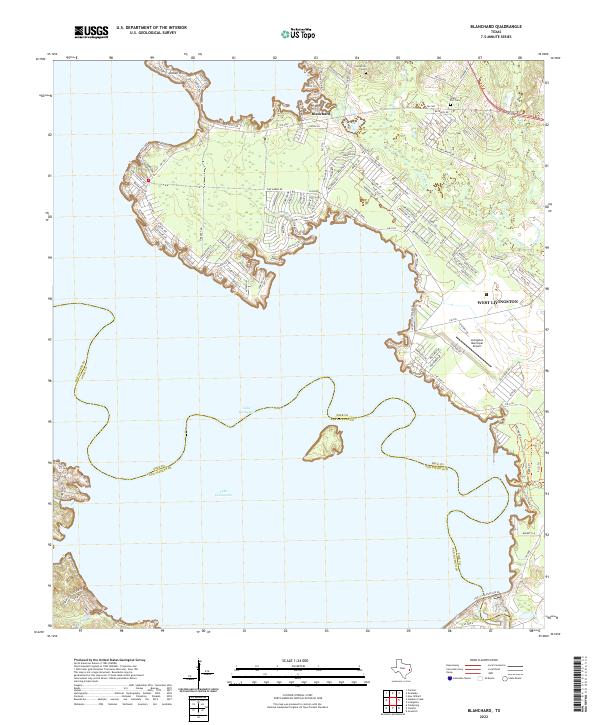
2022 Map of Blanchard
USGS Topo · Published 2022About this map
Lake Livingston dominates this portion of East Texas, its complex shoreline winding through the timbered landscape of Polk and San Jacinto Counties. The settlement of Blanchard sits inland from the northern bays, serving as a hub for local routes like FM 2457 and FM 3126. The map reveals a high concentration of modern residential development along the waterfront, particularly at Indian Hill and the numerous small drives and lanes branching off toward the water's edge.
Find a feature on this map
127 named features on this map. Tap any name to fly to it.
Don’t see what you’re looking for? This feature index may not catch every label — zoom into the map to look around manually.
Map Details
Editions of this 2022 Blanchard Map
This is the sole edition of this map. No revisions or reprints were ever made.
Other maps of this area

1954 · Beaumont
USGS Topo · 1:250,000

1955 · New Willard
USGS Topo · 1:62,500

1957 · Beaumont
USGS Topo · 1:250,000

1958 · Livingston
USGS Topo · 1:62,500

1960 · Blanchard
USGS Topo · 1:24,000

1960 · Carlisle
USGS Topo · 1:24,000

1960 · Stephen Creek
USGS Topo · 1:24,000

1960 · Camilla
USGS Topo · 1:24,000

1960 · Coldspring
USGS Topo · 1:24,000

1961 · Onalaska
USGS Topo · 1:24,000