
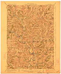
1923 Map of Blanchardville
USGS Topo · Published 1923About this map
The West Branch Pecatonica River and its numerous tributaries carve a deep, intricate drainage pattern across this corner of southwest Wisconsin in the early 1920s. The village of Blanchardville serves as a central hub where the Illinois Central Railroad follows the river's winding course. The map reveals a dense network of country education and worship, documenting now-silent landmarks like the Norwegian Lutheran Church and dozens of one-room schoolhouses such as Whalen School and Jones Valley School that once anchored these rural neighborhoods.
Find a feature on this map
76 named features on this map. Tap any name to fly to it.
Don’t see what you’re looking for? This feature index may not catch every label — zoom into the map to look around manually.
Map Details
Editions of this 1923 Blanchardville Map
2 editions found
Other maps of this area

1902 · Mineral Point
USGS Topo · 1:125,000

1905 · Richland Center
USGS Topo · 1:125,000

1907 · Cross Plains
USGS Topo · 1:62,500

1909 · Cross Plains
USGS Topo · 1:62,500

1920 · Blue Mounds
USGS Topo · 1:62,500

1920 · Monroe
USGS Topo · 1:62,500

1922 · Blue Mounds
USGS Topo · 1:62,500

1922 · Monroe
USGS Topo · 1:62,500

1923 · New Glarus
USGS Topo · 1:62,500

1923 · South Wayne
USGS Topo · 1:62,500