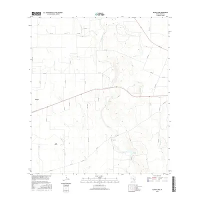
2016 Map of Blanco Lake
USGS Topo · Published 2016About this map
Knippa sits in the western portion of this Uvalde County landscape, where the flat plains begin to meet a network of seasonal watercourses. The hydrology is dominated by the southward flow of Blanco Cr and its tributaries, including Little Blanco Cr and Nolton Cr. These streams converge toward Blanco Lake in the southeast, a focal point in a terrain otherwise marked by subtle depressions like Long Hollow.
Find a feature on this map
38 named features on this map. Tap any name to fly to it.
Don’t see what you’re looking for? This feature index may not catch every label — zoom into the map to look around manually.
Map Details
Editions of this 2016 Blanco Lake Map
This is the sole edition of this map. No revisions or reprints were ever made.
Other maps of this area

1898 · Uvalde
USGS Topo · 1:125,000

1899 · Uvalde
USGS Topo · 1:125,000

1928 · Frio Town
USGS Topo · 1:62,500

1954 · San Antonio
USGS Topo · 1:250,000

1956 · Sabinal
USGS Topo · 1:62,500

1957 · San Antonio
USGS Topo · 1:250,000

1960 · Concan
USGS Topo · 1:24,000

1969 · Comanche Waterhole
USGS Topo · 1:24,000
1969 · Trio
USGS Topo · 1:24,000
1970 · Irishman Hill
USGS Topo · 1:24,000