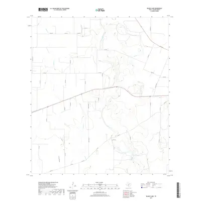
2019 Map of Blanco Lake
USGS Topo · Published 2019About this map
Blanco Cr and its tributaries define this section of Uvalde County, where the Texas hill country begins to level toward the south. The drainage network includes Little Blanco Cr and Nolton Cr, with the latter feeding into Blanco Lake. The landscape is largely defined by rural ranch roads and a winding creek system that creates a distinct pattern of land use centered on water access. A notable point of genealogical interest is the Wish Cem, situated near a bend in Blanco Cr. This 2019 survey documents the modern road infrastructure, including Sunny Clime Rd and Ranch RD 1049, which provide access to the area's isolated homesteads and pastures. The presence of Long Hollow and Dinner Cr to the west further illustrates the complex local hydrology that has shaped cattle ranching and settlement in this portion of the county.
Find a feature on this map
37 named features on this map. Tap any name to fly to it.
Don’t see what you’re looking for? This feature index may not catch every label — zoom into the map to look around manually.
Map Details
Editions of this 2019 Blanco Lake Map
This is the sole edition of this map. No revisions or reprints were ever made.
Other maps of this area

1898 · Uvalde
USGS Topo · 1:125,000

1899 · Uvalde
USGS Topo · 1:125,000

1928 · Frio Town
USGS Topo · 1:62,500

1954 · San Antonio
USGS Topo · 1:250,000

1956 · Sabinal
USGS Topo · 1:62,500

1957 · San Antonio
USGS Topo · 1:250,000

1960 · Concan
USGS Topo · 1:24,000

1969 · Comanche Waterhole
USGS Topo · 1:24,000
1969 · Trio
USGS Topo · 1:24,000
1970 · Irishman Hill
USGS Topo · 1:24,000