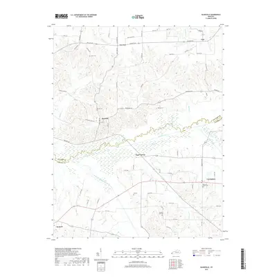
2019 Map of Blandville
USGS Topo · Published 2019About this map
Blandville sits at the center of this rural landscape, surrounded by a high density of family cemeteries and small creek crossings that define the heritage of western Kentucky. The terrain is bisected by the wide, marshy corridor of Mayfield Creek, where Saint Arbor Slough and the West Fork Mayfield Creek meet in a complex wetland system. The map documents the scattered rural community structure typical of this region, with crossroad settlements like New-York, Gage, and Magee Springs connected by a network of winding roads. Genealogists will find significant value in the distribution of burial sites across the ridges, including Hillcrest, Martin, and Robinson cemeteries, providing a detailed look at the local settlement patterns. Farther south, Cunningham and the outskirts of Bardwell appear near the Ballard Co and Carlisle Co line, showing how the local infrastructure navigates the challenging floodplain geography.
Find a feature on this map
65 named features on this map. Tap any name to fly to it.
Don’t see what you’re looking for? This feature index may not catch every label — zoom into the map to look around manually.
Map Details
Editions of this 2019 Blandville Map
This is the sole edition of this map. No revisions or reprints were ever made.
Other maps of this area

1928 · La Center
USGS Topo · 1:62,500

1931 · Cairo
USGS Topo · 1:62,500

1932 · La Center
USGS Topo · 1:62,500

1933 · Cairo
USGS Topo · 1:62,500

1939 · Wickliffe
USGS Topo · 1:62,500

1939 · Cairo
USGS Topo · 1:62,500

1949 · Paducah
USGS Topo · 1:250,000

1950 · Paducah
USGS Topo · 1:250,000

1951 · Blandville
USGS Topo · 1:24,000

1951 · Arlington
USGS Topo · 1:24,000