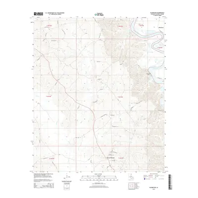
2015 Map of Blankston
USGS Topo · Published 2015About this map
The Ouachita River defines the northeastern landscape of this Caldwell Parish region, where the water bends sharply past Lone Grave Bluff and the oxbow of Horseshoe Lake. The area is characterized by a dense network of secondary roads and local routes, including La-846 and Richmond Rd, which connect the small settlements of Blankston and Mount Pleasant. This 2015 survey reflects a rural landscape shaped by its hydrology, with numerous smaller waterways like Bills Cr, Castor Cr, and Upper Lone Grave Bayou draining the terrain.
Find a feature on this map
92 named features on this map. Tap any name to fly to it.
Don’t see what you’re looking for? This feature index may not catch every label — zoom into the map to look around manually.
Map Details
Editions of this 2015 Blankston Map
This is the sole edition of this map. No revisions or reprints were ever made.
Other maps of this area

1940 · Monroe
USGS Topo · 1:62,500

1940 · Columbia
USGS Topo · 1:62,500

1953 · Chatham
USGS Topo · 1:62,500

1954 · Sikes
USGS Topo · 1:62,500

1955 · Shreveport
USGS Topo · 1:250,000

1956 · Shreveport
USGS Topo · 1:250,000

1957 · Columbia
USGS Topo · 1:62,500

1957 · Monroe South
USGS Topo · 1:62,500

1982 · Chatham SE
USGS Topo · 1:24,000
1982 · Luna
USGS Topo · 1:24,000