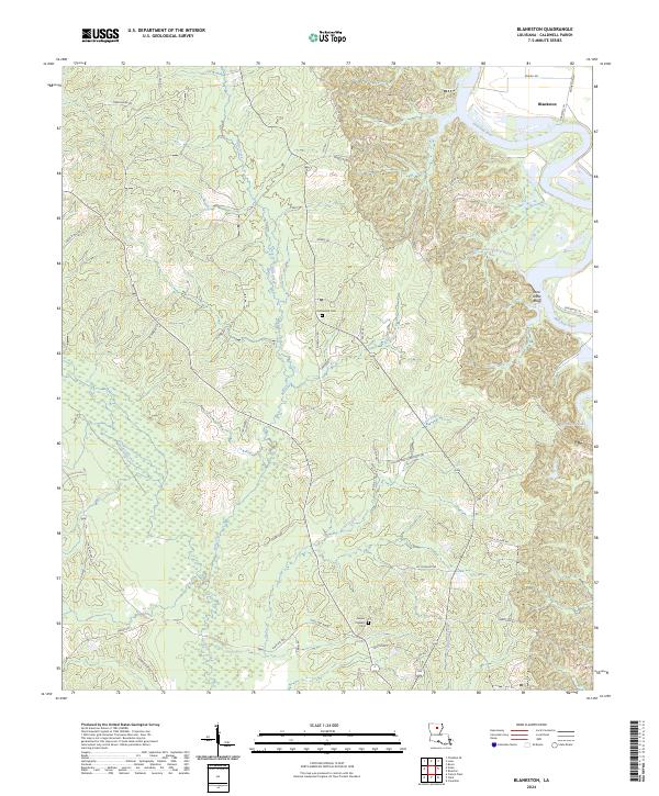
2024 Map of Blankston
USGS Topo · Published 2024About this map
The Ouachita River defines the northeastern boundary of this Caldwell Parish landscape, carving a sharp oxbow near the settlement of Blankston. Below the river's bend, Lone Grave Bluff overlooks a network of waterways including Upper Lone Grave Bayou and Winn Branch. The interior terrain is heavily dissected by numerous drainages such as Bills Creek, Castor Creek, and Lost Creek, which flow through a region marked by rural roads and family-named routes. Genealogical interest centers on Fellowship Cem and Mount Pleasant Cem, located along central and southern transport corridors. The southern portion of the sheet is characterized by the confluence of smaller tributaries like Richland Creek and the presence of Horseshoe Lake, illustrating the complex hydrology typical of the Louisiana lowlands west of the main river channel.
Find a feature on this map
57 named features on this map. Tap any name to fly to it.
Don’t see what you’re looking for? This feature index may not catch every label — zoom into the map to look around manually.
Map Details
Editions of this 2024 Blankston Map
This is the sole edition of this map. No revisions or reprints were ever made.
Other maps of this area

1940 · Monroe
USGS Topo · 1:62,500

1940 · Columbia
USGS Topo · 1:62,500

1953 · Chatham
USGS Topo · 1:62,500

1954 · Sikes
USGS Topo · 1:62,500

1955 · Shreveport
USGS Topo · 1:250,000

1956 · Shreveport
USGS Topo · 1:250,000

1957 · Columbia
USGS Topo · 1:62,500

1957 · Monroe South
USGS Topo · 1:62,500

1982 · Chatham SE
USGS Topo · 1:24,000
1982 · Luna
USGS Topo · 1:24,000