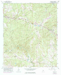
1965 Map of Bleecker
USGS Topo · Published 1984About this map
The Central of Georgia railroad cuts through the heart of this Lee County landscape, linking the small communities of Salem, Shotwell, Bleecker, and Motts. This rural corridor is defined by its water-powered history and local institutions, notably at Moffits Mill where a collection of Falls marks the terrain near the southern edge of the quadrangle. Educational and spiritual centers like Wacoochee High Sch, Antioch Ch, and New Hope Ch serve the surrounding farmstead network.
Find a feature on this map
29 named features on this map. Tap any name to fly to it.
Don’t see what you’re looking for? This feature index may not catch every label — zoom into the map to look around manually.
Map Details
Editions of this 1965 Bleecker Map
3 editions found
Other maps of this area

1907 · Opelika
USGS Topo · 1:125,000

1909 · Opelika
USGS Topo · 1:125,000

1914 · Seale
USGS Topo · 1:62,500

1950 · Crawford
USGS Topo · 1:24,000

1950 · Phenix City
USGS Topo · 1:24,000

1950 · Seale
USGS Topo · 1:62,500

1955 · Phenix City
USGS Topo · 1:24,000

1955 · Crawford
USGS Topo · 1:24,000

1955 · Seale
USGS Topo · 1:62,500

1955 · Phenix City
USGS Topo · 1:250,000