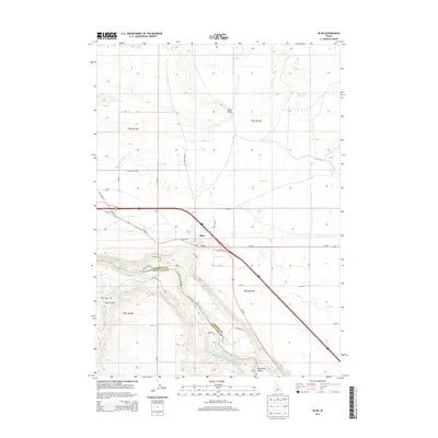
2013 Map of Bliss
USGS Topo · Published 2013About this map
Bliss serves as a critical junction in this high desert landscape, where the agricultural infrastructure of the eastern Snake River Plain meets the canyon rim. The settlement is defined by a complex network of irrigation and transportation, situated where Us-30 E and Us-26 E converge near the Snake River gorge. This 2013 survey illustrates the intensive water management required for the region's ranching and farming, featuring the King Hill Main Canal, Bliss Reservoir, and numerous lateral systems like Lateral Z-6. The topography drops sharply from the plateau at Bliss Point down into the Hagerman Valley, revealing the dramatic elevation changes that characterize the boundary between Gooding and Twin Falls counties. Rural routes such as Clover Creek Rd and Shoestring Rd provide access to the hinterlands, while Last Chance Reservoir stands as a notable landmark in the northern desert reaches.
Find a feature on this map
43 named features on this map. Tap any name to fly to it.
Don’t see what you’re looking for? This feature index may not catch every label — zoom into the map to look around manually.
Map Details
Editions of this 2013 Bliss Map
This is the sole edition of this map. No revisions or reprints were ever made.
Other maps of this area

1892 · Camas Prairie
USGS Topo · 1:125,000

1893 · Camas Prairie
USGS Topo · 1:125,000

1948 · Ticeska
USGS Topo · 1:24,000

1949 · Ticeska
USGS Topo · 1:24,000

1949 · Pasadena Valley
USGS Topo · 1:62,500

1949 · Bliss
USGS Topo · 1:24,000

1949 · Gooding Butte
USGS Topo · 1:24,000

1949 · Tuttle
USGS Topo · 1:24,000

1949 · Hagerman
USGS Topo · 1:24,000

1949 · Indian Butte
USGS Topo · 1:24,000