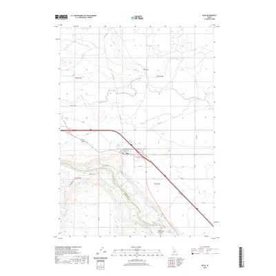
2020 Map of Bliss
USGS Topo · Published 2020About this map
Bliss serves as the central hub of this high desert landscape, positioned where the transport corridor of Old Hwy 30 meets a complex network of agricultural irrigation. The dramatic descent into the Hagerman Valley is defined by the winding course of the Snake River, which carves through the basaltic terrain below Bliss Point. This 2020 survey highlights the vital infrastructure supporting the region's ranching and farming economy, including the King Hill Main Canal and several distribution systems like Lateral Y-4 and Lateral Z-6. Beyond the town center, local thoroughfares such as Hill City Rd and Bliss Grade Rd navigate the steep elevation changes. The map reveals the intricate engineering required to move water across the plateau, with the Y Canal and Z Canal tracing the contours of the land to sustain the homesteads and fields that line the river's path.
Find a feature on this map
37 named features on this map. Tap any name to fly to it.
Don’t see what you’re looking for? This feature index may not catch every label — zoom into the map to look around manually.
Map Details
Editions of this 2020 Bliss Map
This is the sole edition of this map. No revisions or reprints were ever made.
Other maps of this area

1892 · Camas Prairie
USGS Topo · 1:125,000

1893 · Camas Prairie
USGS Topo · 1:125,000

1948 · Ticeska
USGS Topo · 1:24,000

1949 · Ticeska
USGS Topo · 1:24,000

1949 · Pasadena Valley
USGS Topo · 1:62,500

1949 · Bliss
USGS Topo · 1:24,000

1949 · Gooding Butte
USGS Topo · 1:24,000

1949 · Tuttle
USGS Topo · 1:24,000

1949 · Hagerman
USGS Topo · 1:24,000

1949 · Indian Butte
USGS Topo · 1:24,000