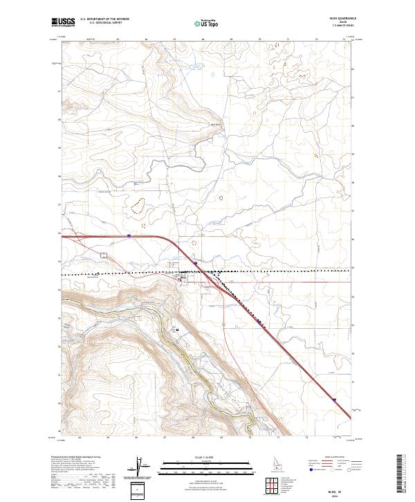
2024 Map of Bliss
USGS Topo · Published 2024About this map
The Snake River carves through the southern landscape of this Idaho quadrangle, defining the steep elevation changes of the Hagerman Valley. The town of Bliss serves as a central hub, situated near the intersection of modern transportation corridors and historic irrigation routes. Water management is a primary feature of the local geography, with a complex network of engineered waterways including the King Hill Main Canal, Y Canal, and Z Canal feeding the surrounding agricultural lands. Cultural history is preserved at the Chinese Memorial Cem and the Bliss Family Cem, providing specific points of interest for genealogists tracing early settlement. The terrain transitions from the high vantage of Bliss Point down into the depths of Tuana Gulch, illustrating the dramatic geological shift from the basalt plateau to the river basin.
Find a feature on this map
39 named features on this map. Tap any name to fly to it.
Don’t see what you’re looking for? This feature index may not catch every label — zoom into the map to look around manually.
Map Details
Editions of this 2024 Bliss Map
This is the sole edition of this map. No revisions or reprints were ever made.
Other maps of this area

1892 · Camas Prairie
USGS Topo · 1:125,000

1893 · Camas Prairie
USGS Topo · 1:125,000

1948 · Ticeska
USGS Topo · 1:24,000

1949 · Ticeska
USGS Topo · 1:24,000

1949 · Pasadena Valley
USGS Topo · 1:62,500

1949 · Bliss
USGS Topo · 1:24,000

1949 · Gooding Butte
USGS Topo · 1:24,000

1949 · Tuttle
USGS Topo · 1:24,000

1949 · Hagerman
USGS Topo · 1:24,000

1949 · Indian Butte
USGS Topo · 1:24,000