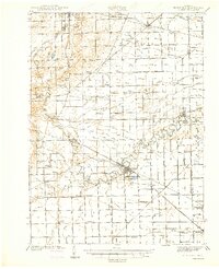
1941 Map of Blissfield
USGS Topo · Published 1941About this map
The Raisin River carves a winding path through the agricultural heart of Lenawee County and Monroe County, anchoring a landscape defined by its intricate drainage network. In the years preceding World War II, this region was a hub of rail activity, with the New York Central and the Toledo and Western lines connecting local agricultural centers. The map reveals a dense distribution of rural institutions, such as Raisinville Sch and Raisin Center Sch, reflecting a time when small, localized school districts were the backbone of the community. Named drains like Hall and Munson Drain and Van Vleet Drain illustrate the extensive land engineering required to support the productive farmland surrounding Blissfield and Deerfield. Smaller crossroads such as Lenawee Junction and Wellsville stand as evidence of the area's historical reliance on both rail transport and local industry.
Find a feature on this map
121 named features on this map. Tap any name to fly to it.
Don’t see what you’re looking for? This feature index may not catch every label — zoom into the map to look around manually.
Map Details
Editions of this 1941 Blissfield Map
2 editions found

Other maps of this area

1900 · Toledo
USGS Topo · 1:62,500

1902 · Ypsilanti
USGS Topo · 1:62,500

1904 · Ann Arbor
USGS Topo · 1:125,000

1906 · Ypsilanti
USGS Topo · 1:62,500

1906 · Saline
USGS Topo · 1:62,500

1908 · Ann Arbor
USGS Topo · 1:125,000

1911 · Wauseon
USGS Topo · 1:62,500

1911 · Swanton
USGS Topo · 1:62,500

1912 · Dundee
USGS Topo · 1:62,500

1913 · Wauseon
USGS Topo · 1:62,500