
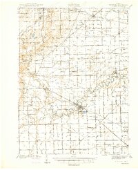
1941 Map of Blissfield
USGS Topo · Published 1941About this map
The Raisin River meanders through the heart of this agricultural landscape in southeastern Michigan, serving as the central topographical anchor for several established rail hubs and rural townships. In the years just before the United States entered World War II, this region was a critical junction of transport, with the New York Central RR, Wabash RR, and the Detroit Toledo and Ironton RR all crisscrossing the terrain. The map captures a dense network of local education and faith, featuring dozens of named schools like Centennial Sch and Kniffan Sch, alongside local landmarks such as Raisinville Cem. The town of Blissfield stands out as a primary settlement, while smaller outposts like Lenawee Junction and Riga Center illustrate the importance of railroad intersections to the local economy and social structure of the early 1940s.
Find a feature on this map
111 named features on this map. Tap any name to fly to it.
Don’t see what you’re looking for? This feature index may not catch every label — zoom into the map to look around manually.
Map Details
Editions of this 1941 Blissfield Map
2 editions found
Other maps of this area

1900 · Toledo
USGS Topo · 1:62,500

1902 · Ypsilanti
USGS Topo · 1:62,500

1904 · Ann Arbor
USGS Topo · 1:125,000

1906 · Ypsilanti
USGS Topo · 1:62,500

1906 · Saline
USGS Topo · 1:62,500

1908 · Ann Arbor
USGS Topo · 1:125,000

1911 · Wauseon
USGS Topo · 1:62,500

1911 · Swanton
USGS Topo · 1:62,500

1912 · Dundee
USGS Topo · 1:62,500

1913 · Wauseon
USGS Topo · 1:62,500