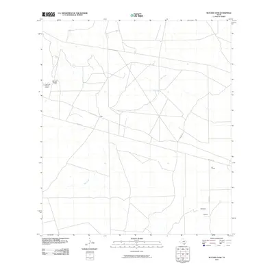
2010 Map of Blocker Tank
USGS Topo · Published 2010About this map
Sage Creek meanders through this portion of La Salle County, defining a landscape of South Texas ranch land and water management. The small settlement of Light sits along Ranch Rd 133, serving as a central point for the surrounding rural tracts. Significant local infrastructure is visible near the western edge of the quadrangle, including Light Lake Number 3 Dam and Light Lake Number 4 Dam, which underscore the importance of water storage in this semi-arid region.
Find a feature on this map
10 named features on this map. Tap any name to fly to it.
Don’t see what you’re looking for? This feature index may not catch every label — zoom into the map to look around manually.
Map Details
Editions of this 2010 Blocker Tank Map
This is the sole edition of this map. No revisions or reprints were ever made.
Other maps of this area

1925 · San Roque Lake 1-a
USGS Topo · 1:48,000

1927 · Bart
USGS Topo · 1:62,500

1929 · Cotulla
USGS Topo · 1:125,000

1932 · Valley Wells
USGS Topo · 1:62,500

1940 · Velenzuela Creek
USGS Topo · 1:62,500

1940 · Catarina
USGS Topo · 1:62,500

1940 · Artesia Wells
USGS Topo · 1:62,500

1953 · Crystal City
USGS Topo · 1:250,000

1955 · Crystal City
USGS Topo · 1:250,000

1957 · Encinal
USGS Topo · 1:62,500