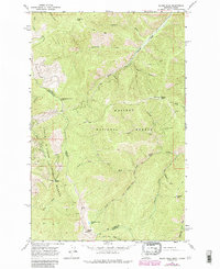
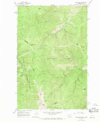
1966 Map of Bloom Peak
USGS Topo · Published 1984About this map
Kaniksu National Forest and Coeur D'Alene National Forest meet at the boundary of Sanders and Shoshone counties, where this 1966 field-checked survey documents a landscape of high summits and drainage networks. High points such as McNeeley Peak and Bloom Peak dominate the topography, while the high-elevation Ninetythree Mile Lake sits just east of the state line. The map captures a moment in the mid-1960s before 1982 aerial updates, showing the intersection of the Idaho-Montana border through Taylor Saddle.
Find a feature on this map
34 named features on this map. Tap any name to fly to it.
Don’t see what you’re looking for? This feature index may not catch every label — zoom into the map to look around manually.
Map Details
Editions of this 1966 Bloom Peak Map
3 editions found
Other maps of this area

1932 · Trout Creek
USGS Topo · 1:125,000

1935 · Trout Creek
USGS Topo · 1:125,000

1936 · Trout Creek
USGS Topo · 1:125,000

1956 · Cooper Gulch
USGS Topo · 1:62,500

1956 · Wallace
USGS Topo · 1:250,000

1957 · Burke
USGS Topo · 1:62,500

1960 · Wallace
USGS Topo · 1:250,000
1966 · Noxon Rapids Dam
USGS Topo · 1:24,000
1966 · Taylor Peak
USGS Topo · 1:24,000
1966 · Bloom Peak
USGS Topo · 1:24,000