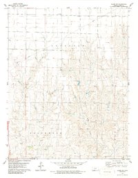
1979 Map of Bloom SW
USGS Topo · Published 1986About this map
Appleton, Englewood, and Center townships define the administrative landscape of this southwest Kansas region during the mid-1970s. The topography is deeply incised by the drainage systems of Keiger Creek and Little Sandy Creek, which flow southward through the prairie. Water sources are a critical feature of this semi-arid terrain, evidenced by several marked Springs and an isolated Spring located near the prominent Sugarloaf elevation. Small local landmarks like Jacobs and Pike offer specific points of interest for genealogists tracing family locations in Clark County. A Radio Tower stands in the northern section, while a modern Pipeline cuts diagonally across the northern townships, signaling the industrial infrastructure present alongside traditional land uses like the Gravel Pit in the southwest. This survey represents the area as it was recorded just before the 1980s, preserving the exact locations of rural fence lines and section boundaries.
Find a feature on this map
15 named features on this map. Tap any name to fly to it.
Don’t see what you’re looking for? This feature index may not catch every label — zoom into the map to look around manually.
Map Details
Editions of this 1979 Bloom SW Map
2 editions found
Other maps of this area

1892 · Meade
USGS Topo · 1:125,000

1896 · Ashland
USGS Topo · 1:125,000

1955 · Pratt
USGS Topo · 1:250,000

1955 · Dodge City
USGS Topo · 1:250,000

1958 · Dodge City
USGS Topo · 1:250,000

1959 · Pratt
USGS Topo · 1:250,000

1959 · Dodge City
USGS Topo · 1:250,000

1967 · Bloom
USGS Topo · 1:24,000

1967 · Fowler SE
USGS Topo · 1:24,000

1967 · Minneola
USGS Topo · 1:24,000